Discover the power of GPS devices for Africa overland expeditions. From essential navigation with paper maps and rally points to advanced solutions utilizing client browser systems and participant phones, we explored different approaches. Using a minimum-better-best method, this comprehensive article emphasizes backup plans, mounting options, and device protection. Join our charitable expedition distributing 3D prosthetics and make a difference. Prepare for a timesaving read with our extensive research review on GPS devices, navigation techniques and tools.
I. Introduction
When embarking on an Africa overland expedition, reliable navigation becomes a top priority. The vast and diverse landscapes of Africa present unique challenges that demand accurate guidance. This is where GPS devices step in as indispensable tools.
By offering real-time positioning, detailed maps, and essential features, GPS devices empower adventurers to navigate with confidence through unfamiliar terrains. They enable precise route planning, allow marking of points of interest, and ensure staying on track even in remote areas where traditional maps might fall short.
With offline map access and integration with useful apps, GPS devices enhance the overall navigation experience. Whether it’s avoiding getting stuck, regrouping at designated rally points, or communicating positions during emergencies, GPS devices are instrumental in ensuring a safe and successful overland journey.
In the following sections, we will delve into various navigation approaches, recommended apps and devices, and provide valuable tips for mounting and protecting your GPS devices. Prepare to unlock the full potential of GPS navigation for your thrilling Africa overland expedition.
II. Understanding Navigation Requirements
Minimum Navigation Approach
When it comes to navigation in Africa or anywhere in general, paper maps are a fundamental requirement. These maps provide essential information, including topography, landmarks, and often local points of interest. It is crucial to ensure that you keep paper maps up-to-date to reflect any changes in roads, infrastructure, or natural features.
More so with your collected information during the expedition. Think about the last working gas station, options to buy groceries or medical clinics and other points of interest. By having accurate paper maps, you can rely on them as backup for emergencies or a primary source of navigation if you are looking for a challenge.
In the event of unforeseen circumstances that may cause separation within the expedition team, rally points play a vital role. These designated meeting places act as gathering points where team members can regroup, reassemble, and reorganize.
Rally points are typically chosen strategically, considering factors such as accessibility, visibility, and safety. They serve as a rendezvous for the team, ensuring everyone is accounted for and enabling a swift response to unexpected situations.
Typically in contrast to waypoints, rally points will be identified and communicated when the team has passed and seen them in person, not just solely on a map. If roadblocks or checkpoints are a concern, the closest upcoming waypoint might be used.
Better GPS Device
In addition to the minimum navigation approach, there is a better way to navigate during an Africa overland expedition, leveraging the power of GPS devices. By incorporating client browser systems that are compatible with multiple platforms, such as an iPad with Gaia GPS, adventurers can elevate their navigation experience to new heights.
With this approach, participants can utilize their own GPS-enabled devices, including smartphones, as reliable backup navigation tools. This proves invaluable in emergency situations or when individuals become separated from the main group. By using a multi-platform software solution like Gaia GPS, the expedition leader or lead navigator can easily update the route and instantly share it with the team without interrupting the driver’s GPS device or the ongoing routing. This seamless integration allows for efficient collaboration and enables everyone to stay on track.
One of the significant advantages of this approach is that each participant can actively contribute to the navigation process. They can input points of interest or update important information in real-time, as long as they have access to a Wi-Fi network. This level of involvement and contribution ensures that the expedition remains flexible and adaptable to changing circumstances.
Important To Know: Navigating High Heat Environments
In our recent ventures, we’ve encountered a notable challenge when relying on mobile devices like iPads, iPhones, and Android devices for navigation in high heat environments. These devices tend to struggle or even shut down entirely when exposed to excessive temperatures or direct sunlight, compromising their reliability. To avoid such mishaps, it’s essential to opt for proven solutions that can withstand the heat without skipping a beat. If you find yourself dependent on GPS devices in such conditions, steer clear of iPads or iPhones—they simply can’t handle the heat.
Best Navigation Setup
When it comes to navigating during an overland expedition, mitigating risks and ensuring a robust contingency plan is of paramount importance. In stressful emergency situations, clear communication and the ability to convey vital information and precise positioning can be a lifesaver.
To achieve this, it is essential to incorporate emergency GPS devices like the Garmin InReach Mini into your navigation toolkit. These devices provide reliable and easy-to-use communication capabilities, enabling seamless execution of contingency plans during emergencies. By having an emergency GPS device on hand, adventurers can stay connected, share critical information (including tracking and map sharing with family&friends), and coordinate rescue efforts if necessary.
In the best navigation approach, redundancy becomes a key principle. It is crucial to have a separate GPS device as a backup, ensuring that navigation systems remain functional even in the event of technical failures or unforeseen circumstances. This redundancy provides an extra layer of reliability, allowing for continued navigation and avoiding potential setbacks.
Moreover, opting for handheld GPS devices offers the advantage of portability. In situations where the vehicle needs to be left behind or when the group is on foot, a handheld emergency GPS device can be easily carried along. This ensures that essential navigation tools are accessible at all times, regardless of the mode of transportation.
By embracing the best navigation approach with GPS devices, adventurers can prioritize safety, communication, and contingency planning. Incorporating emergency GPS devices, emphasizing redundancy, and opting for handheld options contribute to a comprehensive and reliable navigation system during an overland expedition.
Our favorite choice to finish the best navigation system is the Garmin InReach Mini 2. If you are interested in more of our top picks of overland travel essentials, go HERE.
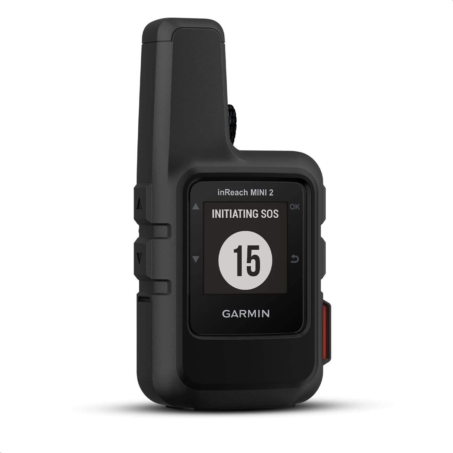
Garmin InReach Mini 2
- TWO-WAY SATELITE MESSAGING
- INTERACTIVE SOS ALERTS
- LOCATION SHARING
III. Enhancing Navigation with Useful Apps
When it comes to maximizing the potential of GPS devices for navigation during an Africa overland expedition, incorporating useful apps can take the experience to the next level. These apps offer additional functionalities and valuable resources that complement the capabilities of GPS devices.
Tracks4Africa
Tracks4africa is a highly recommended app for Africa overland adventures. It provides detailed offline maps specifically designed for navigating the African continent. With comprehensive coverage and up-to-date information on roads, tracks, and points of interest, Tracks4africa ensures accurate and reliable navigation even in remote areas with limited connectivity. By leveraging this app, adventurers can confidently explore Africa’s diverse landscapes, discover hidden gems, and make informed decisions about their routes.
iOverlander
iOverlander is another invaluable app for GPS device users. It serves as a community-driven platform that offers a wealth of information on camping spots, fuel stations, repair shops, and other essential resources for overland travelers. By utilizing iOverlander, adventurers can easily locate suitable campsites, find reliable services, and benefit from the collective knowledge and experiences of fellow travelers. This app enhances convenience, provides valuable insights, and facilitates smoother navigation throughout the journey.
Google Maps
While Google Maps may seem like a ubiquitous choice, it remains a powerful tool for navigation. With its extensive database, turn-by-turn directions, and real-time traffic updates, Google Maps offers a reliable backup option for GPS devices. It can be particularly useful when navigating within cities, finding specific landmarks, or identifying nearby amenities. Integrating Google Maps into your navigation toolkit provides an extra layer of flexibility and accessibility.
One could also use the real-time location sharing option to track the group.
Aside from these navigation-focused apps, utilizing an iPad for navigation purposes opens up a world of possibilities. The iPad’s larger screen size and versatility allow for additional features that can enhance the navigation experience. For instance, storing checklists, including essential medical references, and carrying the searchable PDF version of the Oxford Handbook of Wilderness Medicine can prove invaluable during remote expeditions. This comprehensive medical resource provides vital information for managing medical emergencies in wilderness settings, ensuring the safety and well-being of the expedition team.
By incorporating these useful apps and leveraging the capabilities of an iPad, adventurers can augment their GPS devices and unlock a wealth of resources, insights, and convenience, all contributing to a seamless and successful Africa overland expedition.
IV. All-In-One Navigation with the Garmin Tread Overlander
When it comes to finding a comprehensive and reliable GPS device for Africa overlanding, the Garmin Tread Overlander stands out as an exceptional all-in-one solution. With its impressive features and user-friendly design, the Garmin Tread Overlander offers a seamless navigation experience tailored specifically for overland expeditions.
Feature Overview
Equipped with a robust set of features, the Garmin Tread Overlander ensures that adventurers have everything they need at their fingertips. It combines precise GPS navigation with a rugged design, making it suitable for the challenging terrains and conditions encountered during Africa overland journeys. With detailed topographic maps, off-road navigation capabilities, and extensive route planning functionalities, the Garmin Tread Overlander empowers adventurers to confidently explore even the most remote and off-the-beaten-path locations.
One of the standout features of the Garmin Tread Overlander is its integration with the iOverlander app. This app serves as a valuable resource for overland travelers, providing information on camping spots, fuel stations, and other essential services. With the Garmin Tread Overlander’s built-in compatibility, adventurers can seamlessly access and leverage the iOverlander app, enhancing convenience and facilitating smoother navigation throughout the expedition.
SOS and Emergency Satellite Communication Integration
Additionally, the Garmin Tread Overlander comes with Garmin InReach capabilities already built-in. This means that adventurers can enjoy the benefits of two-way satellite communication, enabling them to share their location, send messages, and even summon assistance in case of emergencies. This added safety feature provides peace of mind and ensures that help is just a message away, even when venturing into remote areas with limited cell service.
With its robust features, user-friendly interface, and integration with the iOverlander app and Garmin InReach capabilities, the Garmin Tread Overlander emerges as a top choice for all-in-one navigation during Africa overland expeditions. By utilizing this GPS device, adventurers can navigate with confidence, explore off-the-grid destinations, and stay connected in case of emergencies.
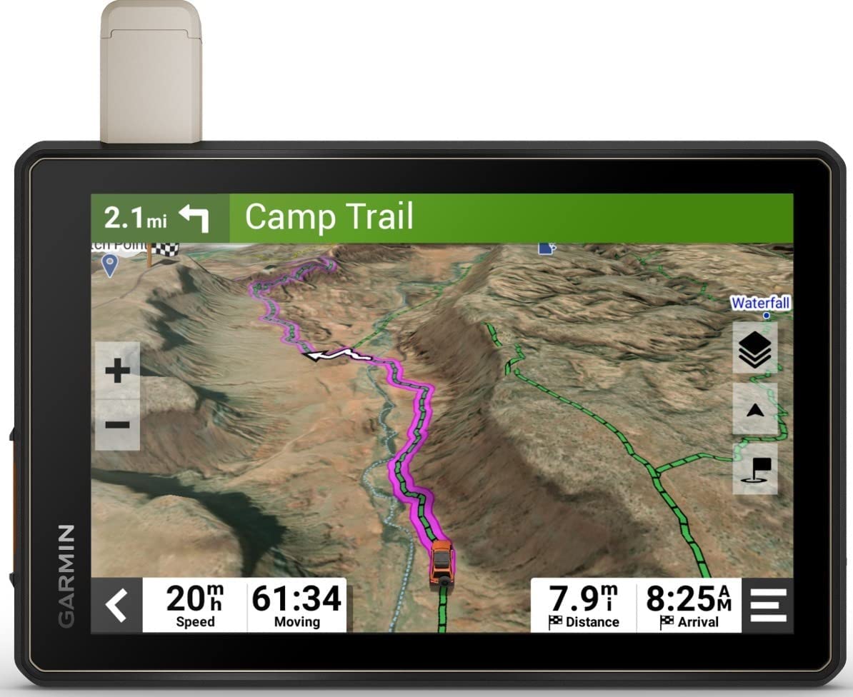
Garmin Tread Overland
- OFF-ROAD RUGGEDNESS
- BUILT-IN INREACH TECHNOLOGY
- SATELLITE IMAGERY
V. Mounting and Protecting GPS Devices
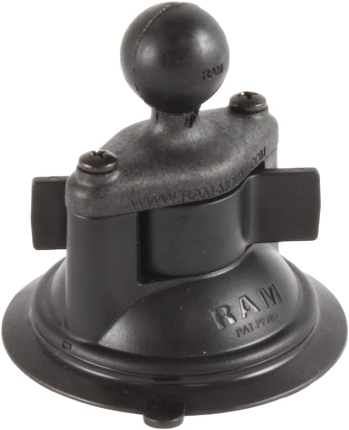
Proper mounting and protection of GPS devices are essential considerations when embarking on an Africa overland expedition. Not only does it ensure convenience and accessibility, but it also contributes to the overall safety and longevity of the devices. When it comes to reliable and versatile mounting options, RAM Mounts emerges as a top choice among overlanders.
RAM Mounts are renowned for their exceptional versatility and reliability. These mounts offer a wide range of options that can be easily attached to various vehicles, regardless of their make or model. With RAM Mounts, adventurers can securely attach their GPS devices to handlebars, roll bars, or any other suitable location, providing optimal visibility and accessibility throughout the journey.
To determine the appropriate mount size for your GPS device, consider the following recommendations:
B-size (1″/25.4mm) system: Ideal for mounting mobile phone-sized devices.
C-size (1.5″/38.1mm) system: Suitable for tablets and larger GPS devices.
For a detailed comparison of mount sizes, weights, and maximum supported weights, refer to the table below:
Comparison Chart
| System | Size | Supported Max. Weight | Device Examples |
| B | 1″/ 25.4mm | 2 lbs/ 0.9kg | Smartphones, GPS Devices, GoPro’s |
| C | 1.5″/ 38.1mm | 4 lbs/ 1.81kg | Tablets, Cameras |
| D | 2,25″/ 38,1mm | 6 lbs/ 2.72kg | Laptops |
In addition to proper mounting, protecting GPS devices is crucial to ensure their longevity and performance. For iPads or tablets used during the expedition, consider investing in UV-protected aiShell cases from Andres Industries. These cases provide reliable protection against dust, scratches, and impact, safeguarding the devices from the harsh conditions encountered during overlanding. The aiShell cases are designed to work seamlessly with RAM Mounts, offering convenience and peace of mind.
While RAM Mounts and aiShell cases are highly recommended, it’s worth mentioning Scanstrut as an alternative for mounting options, especially for mobile phones that support wireless charging. However, please note that in some cases, wireless charging may not be sufficient when the phone is connected via wireless CarPlay for music and navigation purposes. It’s important to consider these limitations and ensure that the phone’s battery is not drained during the journey.
By prioritizing proper mounting and protecting GPS devices with reliable solutions like RAM Mounts and aiShell cases, overlanders can enhance convenience, accessibility, and the overall longevity of their navigation tools, ensuring a seamless and reliable navigation experience throughout the Africa overland expedition.
Mounting Options on the Vehicle Side
You have a variety of alternatives depending on how eager you are to drill into your car’s dashboard. Here are just a few:

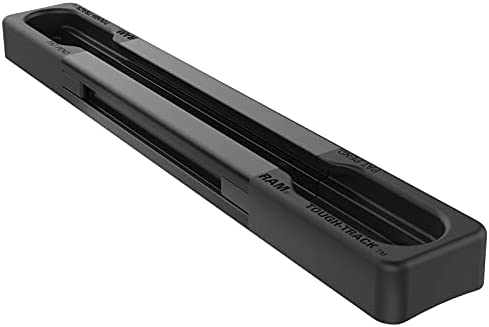
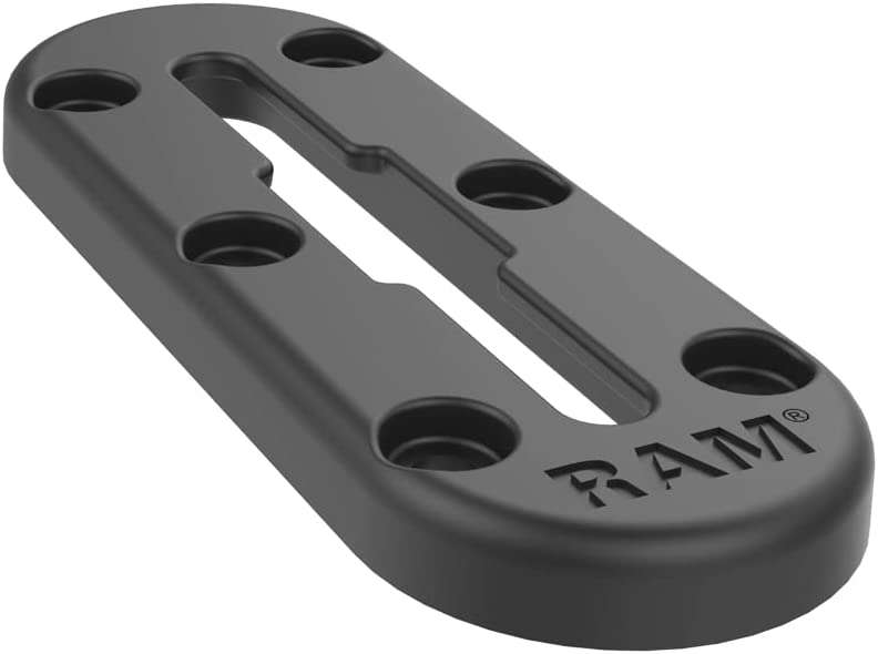
Track Ball with T-Bolt Attach – C-size, RAP-354U-TRA1
- Can be used with C sized arms and holders

Round Plate with Ball – B Size, Ram-B-202U
- Single ball mount for B sized arms and holders
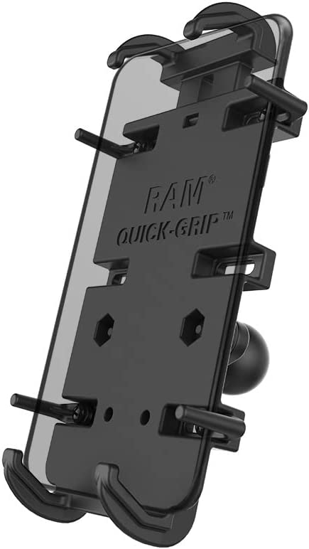
Mounting Solutions for Mobile Phones and GPS Devices (Size B)

Quick-Grip™ 15W Waterproof Wireless Charging Holder with Ball – B size, RAM-HOL-UN14WB-1
Mounting Solution for Tablets (Size C)
Alternative Simple Mounting Solution for Tablets as GPS Devices
Scanstrut’s Screw Down Mount Kit is probably the toughest mounting system for your Tablet you can find.
The Screw Down Base Kit allows you to mount your tablet on any flat surface. The 360-degree aluminium body features a metal-on-metal locking system that multiplies your clamping efforts to achieve 100% locking force. Your Tablet will never move until you want it to.

ScanStrut Tablet Screw Down Mount Kit
- Secure mount for mini and full-size tablets – ratchet adjustable
- Fits devices from 125mm to 220mm (5-8¼”) horizontally
- Tough, marine-grade, UV stable materials.
- metal-on-metal locking system to achieve 100% locking force
Best Hard Case for iPads
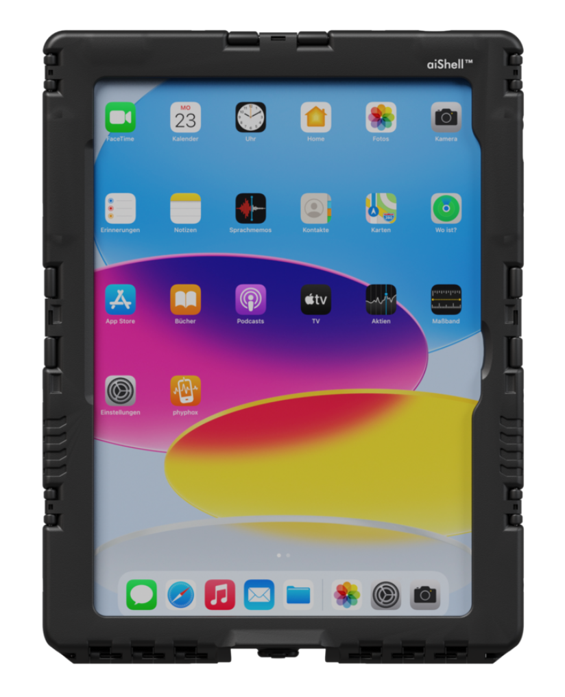
Andres Industries aiShell 10.9
- suitable for Apple iPad 10th Generation (A2696; A2757 , A2777) – others are available!
- waterproof (IP67)
- impact resistant (MIL-810-G)
- UV stable hybrid glass film
The iPad’s buttons and cameras can be used without any issues from the outside. Because of light guides the tablet’s light sensor is still fully operational. The aiShell 10.9TM maintains its waterproofness even when charging thanks to the aiShellTM Charging Connector – USB-C (sold separately).
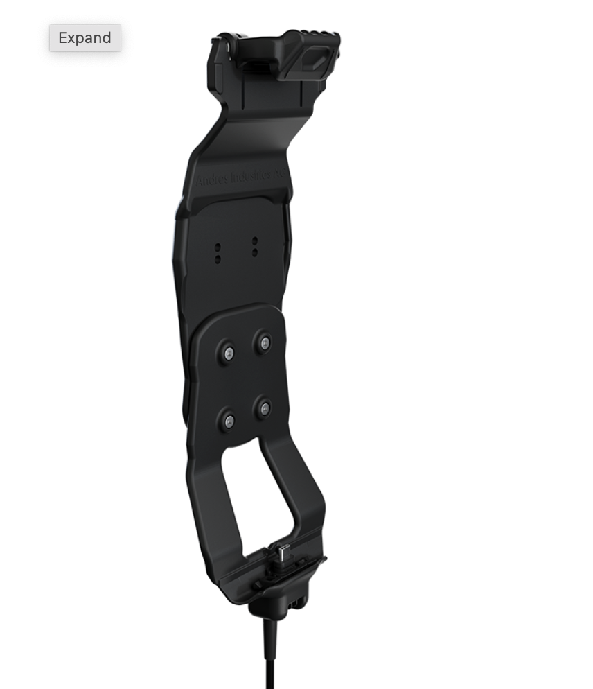
Andres Industries aiShell CarCradle USB-C
- for aiShell 8 / 11 / 12
- Cable length: 1m, 2m or 3m
- Connection on the cable end: USB-C
- RAM Mount compatible
The most best mounting and charging solution for iPads is the Andres Industries Car Cradle. It is especially well suited for users who must repeatedly place the tablet into a holder so that it may be loaded right away. This is crucial, for instance, for delivery drivers, maintenance workers, and emergency services. Inserting or removing the case from the car cradle just takes a few seconds. The charging procedure begins and stops automatically after the battery has been charged.
The waterproof Car Cradle Connector can be attached to the base of the aiShellTM in place of a regular USBC-C connection or the Charging Connector. With the support of two screws, it is firmly attached. It features two tough gold-plated touch surfaces on its bottom. The device is loaded using this after being inserted into the Car Cradle.
Ram Mount itself offers a similar docking station type solution which we have no experience with but can be found HERE
VI. Conclusion
In conclusion, GPS devices play a vital role in ensuring accurate navigation during Africa overland expeditions. They provide adventurers with the necessary tools to navigate unfamiliar terrains, plan routes, and stay on track. Throughout this article, we have explored various navigation approaches according to the minimum, better, best approach.
Furthermore, we discussed the value of useful apps such as Tracks4africa, iOverlander, and Google Maps, which provide valuable information and enhance the navigation experience. We also highlighted the convenience of storing checklists and medical references using an iPad.
As we conclude, we want to emphasize the importance of backup plans, versatile mounting options, and device protection for a successful and enjoyable overland journey. These elements provide peace of mind, enhance safety, and contribute to a seamless navigation experience.
On a final note, we would like to disclose that this article was developed in preparation for an charity expedition focused on distributing 3D prosthetics along west africa. We are passionate about making a positive impact, and any support for this noble cause would be greatly appreciated. Together, we can make a difference and bring hope to those in need.
Thank you for joining us on this journey, and if you got something out of this article, we encourage you to consider contributing to the charity expedition. Every donation helps us provide life-changing support to those who need it most.

